Categories > Guides and Tips
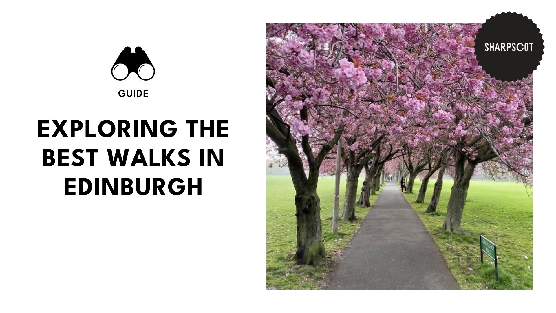
10 of Edinburgh’s Must-Walk Routes, Trails, and Parks

Walking has always been one of my favourite ways to unwind and clear my head. Back in uni, I’d head right to the park right after an exam, just to breathe, decompress, and enjoy a bit of fresh air. Before I knew it, I had walked 10,000 steps! That’s how I dodged the freshman 15.
Now, I won’t lecture you on all the benefits of walking, as chances are you already know that. That’s probably why you’re here, and not for my TED Talk. So let’s walk on, shall we? (Pun intended. No regrets!).
This list has it all, from breezy strolls on manicured parks to proper leg burners that’ll have you questioning your life choices. Choose wisely. Now, let’s get moving!
Easy Walks
The Meadows
Media Credit: thisisedinburgh
Difficulty: Very easy–flat, paved, and wheelchair-friendly
Length: About 2.3 km (1.4 miles) but stretches to around 4 km (2.5 miles) if combined with Bruntsfield Link
Amenities: Children’s playgrounds, tennis courts, cricket pitches, public toilets, nearby café, seasonal kiosks, and scattered benches
Getting There:
- By foot: A 10-minute walk from the Royal Mile or Waverly station, from South Bridge or Teviot Palace
- By bus: Take the Lothian Buses (routes 3,5,7,8,29,30,31…) that stop on Melville Drive
- By tram: Get off at Shandwick Place, then it’s an easy 15-minute walk
The Meadows is one of my favourite urban escapes as it’s perfect for virtually every activity.
Planning an afternoon picnic? You’ll find wide, well-kept lawns just waiting for your blanket. Got the pram with you? The smooth, tree-lined paths are great for a gentle walk with your little one.
In spring, the cherry blossoms are in full bloom with vibrant, open-air festivals, while summers are perfect for BBQs and people-watching. In autumn, it’s ideal for quiet walks with a hot cup of chocolate in hand, while winter’s more serene, especially with a dust of snow.
Local Tip: Bring coins to use the public toilets near the playground.
Princes Street Gardens
Media Credit: scotland_sc
Difficulty: Very easy–flat, paved, with central ramps
Length: Around 1.5 km for a full East-West walk, but can extend to 2 km with detours around monuments
Amenities: Public restrooms, nearby cafes and kiosks, and children’s play areas
Getting There:
- By foot: Entry points from Princes Street (Central Station exit) or Waverly Bridge include The Mount, King Stables Road, and Market St
- By train/tram: Get off at Waverly or Princes Street
My favourite kind of stroll is one packed with history and art. You’ll get just that at Princes Street Garden. From the ornate 19th-century Ross Fountain to the gothic Scott Monument, there’s beauty in every corner.
Yet even on a normal day, it’s perfect for relaxing breaks from the hustle and bustle of the city or a stroll along its interconnected pathways, both wheelchair and pram-friendly.
Local Tip: Stay tuned for events such as international festivals, summer concerts, and Christmas markets.
Craigmillar Castle Park
Media Credit: elgtcraigmillarcastlepark
Difficulty: Easy–wide, mostly paved with some parts involving uneven cobbles or gravel but with no climbs
Length: About 1.5 km (1 mile)
Amenities: Public toilets at Old Calton Burial Ground, nearby mobile coffee carts, cafés and restaurants, scattered benches
Getting There:
- By foot: A quick 5-minute walk from Princes Street or Waverly Station. Remember to enter through Regent Road, Royal Terrace, or Waterloo Place stairs.
- By bus: Take Lothian Buses 1, 4, 10, 12, 19, 26, or 44 to Princes Street or Leith Street. From there, walk up the hill.
If you enjoy walks that give you 360° postcard views with minimal effort? Then, Craigmillar Castle Park is the way to go. It’ll take you less than an hour to go through the entire length of the park, sweeping up solid nature views and a little bit of history while you’re at it.
The incline is mild and the loop is short, allowing you to cover major landmarks without even leaving the city centre. Just be sure to wear sturdy shoes and bring an extra layer, as Calton Hill is rather exposed, making it a bit chilly.
Local Tip: For easier pram and wheelchair access, avoid the stairs from Waterloo Place. Instead, use the Regent Road Entrance near Burns Monument.
Moderate Walks
Blackford Hill & The Hermitage of Braid
Media Credit: bryonyjane.x
Difficulty: Moderate–mostly flat, sheltered woodland, but reaches a steep grassy incline to the summit
Length: Around 4 to 5 km (2.5 to 3 miles)
Amenities: Free parking and limited public toilets
Getting There:
- By foot: From Morningside, walk 10 to 15 minutes up Braid Road or through Midmar Drive until you reach the Hermitage entrances
- By bus: Take the Lothian Bus 41 or Bus 15 from Princes Street or North Bridge, then get off at Comiston Road at Braidburn Terrace for the Midmar Drive entrance or at the Morningside Station area for a short walk to the Braid Road or Hermitage entrances.
Walking at Blackford Hill and The Hermitage of Braid is one of my favourite things because of its scenic blend of peaceful woodlands and sweeping city views, all at the heart of Edinburgh.
The first half of the trail is relatively easy to get through. There’s a calming canopy of trees, and the quiet stream drowns out the city sounds the farther you go. From there, it’s uphill towards Blackford Hill, but don’t worry, the panoramic Edinburgh views are well worth the climb.
Local Tip: Wear sturdy footwear. Even in summer, the trails can be rocky, muddy, and slippery, especially after rain, so hiking boots or waterproof trainers are a must.
Royal Botanic Garden to Stockbridge Loop
Media Credit: buthanina
Difficulty: Moderate–flat, paved or gravel paths, suitable for prams and wheelchairs (some cobbles in Stockbridge may be uneven)
Length: About 3.5 to 4.5 km (2 to 3 miles)
Amenities: Benches throughout the park, multiple nearby cafés, public toilets
Getting There:
- By bus: Take Lothian Buses 8, 23, or 27 from Princes Street or North Bridge, then get off at Arboretum Place or Inverleith Row. From there, it’s a short 2 to 5 minute walk.
If you enjoy walks with some botanical charm, then this one’s a winner. You’ll first walk through the winding landscaped paths within the Royal Botanical Garden, a big leafy playground with each season’s blooms different from the last, so there’s plenty to see.
Then, into the charming village of Stockbridge, particularly, the photogenic streets of Circus Lane. Here, time slows down and the streets are quiet, perfect for soaking up the Edinburgh magic with some coffee and a pastry.
Local Tip: Take this route on a Sunday, then visit the Stockbridge Market after.
Dean Village Trail
Media Credit: scotland.in.my.heart
Difficulty: Moderate
Length: 2 km (1.25 miles) one way
Amenities: Public toilets in Stockbridge Library, nearby cafés and shops
Getting There:
- By foot: From Princes Street, it’s a 15 to 20-minute walk
- By bus: Take Lothian Buses 19, 37, or 41 to Queensferry or Belford Road
If you’ve never been to Dean Village, walking through it is one of the best ways to experience it. With cobbled streets, historic buildings, and mossy bridges, it’s one of Edinburgh’s most fairytale-like neighborhoods tucked away by the Water of Leith.
The walk doesn’t even feel like a hike. Getting around feels more like wandering through the set of a period drama. I can just hear the soft piano in the background. Kidding aside, trust me, you’ll catch yourself pausing often to snap a photo and admire the scenery.
Local Tip: Wear comfortable walking shoes with a sturdy grip as the cobblestone paths can be slippery, especially after rain.
Corstorphine Hill & Tower
Media Credit: emmajane78
Difficulty: Moderate–uneven paths with some uphill sections
Length: About 4 km (2.5 miles) loop
Amenities: Scattered benches and resting areas along the trail, free parking on Clermiston Road North
Getting There:
- By foot: Around 10 minutes from Corstorphine High Street
- By bus: Take Lothian Buses 26, 31, or 100 to Corstorphine Road
Even though it’s tucked away in Edinburgh’s west side, it’s not as far away from the city as it seems. The loop is easy enough, with no major ascents or scrambles.
The only challenge is navigating the uneven, root-covered paths, but it’s no bother, just enough to get your heart rate up. It also happens to be my pup’s favourite walk as there’s plenty to sniff and new trails to explore.
Local Tip: While the well-worn paths are easy to spot, there are few signages, so ensure you take a photo of the map by the entrance or use a GPS trail app.
Challenging Walks
Arthur’s Seat via Salisbury Crags Loop
Media Credit: shelbynicolestarnes
Difficulty: Moderate to Challenging–uneven terrain with steep inclines
Length: About 4.5 km (2.8 miles)
Amenities: Toilet facilities and small cafés
Getting There:
- By foot: Around 10 to 15 minutes from the Royal Mile
- By bus: Take Lothian Buses 6, 35, or 36 to
If you don’t mind a bit of a workout up an ancient extinct volcano, then you’ll love walking the well-worn path up Arthur’s Seat. Don’t mind a challenge? Trek up the park’s highest peak at 251 meters (823 ft) for the best panoramic views over Edinburgh Castle and the Firth of Forth.
As challenging as it sounds, it’s quite manageable. Think of it as a mini mountain walk right at the heart of Edinburgh rather than a technical hike. While some strenuous sections will need a bit more effort, you just need proper walking shoes and stamina.
Local Tip: The terrain gets muddy and slippery quickly, so turn back if it seems like it’ll rain soon.
Allermuir Hill
Media Credit: donnie_campbell84
Difficulty: Challenging–steep climbs with fierce winds
Length: 6.4 km (4 miles)
Amenities: None on the trail itself
Getting There:
- By bus: Take Lothian Buses 4 or 27 to Oxgangs or Swanston Road, then it’s about 15 minutes to the start
Don’t be fooled by the postcard-perfect views of Swanston Village, as this is a proper hill walk, not just a stroll. From the foot of the Pentlands, it’s uphill past the farmlands and grassy ridgelines, so expect to make a few rest stops to catch your breath.
Once you get to the summit, up 493 meters, the sky-heavy views will be all worth it. Trust me, you’ll get that “king of the world” feeling watching the clouds and distant cityscapes.
Local Tip: Bring water, snacks, and anything else you might need as there’s no shelter or facilities on the trail. You’ll need to drive back into town to get to the nearest store.
Carnethy Hill
Media Credit: andrewdmcd
Difficulty: Challenging–steep climbs and exposed summit
Length:
- Short Direct Route: About 5.5 km (3.4 miles) from The Howe
- Longer Circular Route: About 10 to 11 km (6.8 miles) from Flotterstone car park
Amenities: Toilet facilities at Flotterstone Information Centre, parking at the Flotterstone car park
Getting There:
- By bus: Take Bus 101/102 or Bus 37 to Flotterstone or Milton Bridge, then it’s about 15 minutes to walk to the trailhead.
- By car: Around 25 minutes from Edinburgh city centre to Flotterstone Car Park.
While getting to Carnethy Hill is quite straightforward with a classic up-and-down route, it’s one of the steepest climbs in the Pentlands that’ll demand more stamina. A proper leg-burner, it’s all just rough grass and muddy trails.
Carnethy is also heavily exposed to strong winds, especially on the summit’s ridge, so you’ve got to be careful. But when you reach the top, the views are glorious and so worth it. That is, until you’ve got to descend, which is a proper quad killer.
Local Tip: Tackle Carnethy Hill in zigzags rather than straight up to reduce leg strain and conserve energy.