Categories > Guides and Tips
A Complete Guide to Scotland’s Must-See Standing Stones

- Calanais Standing Stones
- How to Hike to Calanais Standing Stones
- Ring of Brodgar
- How to Hike to the Ring of Brodgar
- Stones of Stenness
- How to Hike to the Stones of Stenness
- Machrie Moor Stone Circles
- How to Hike to the Machrie Moor Stone Circles
- Clava Cairns
- How to Hike to Clava Cairns
- Temple Wood
- Temple Wood Hike Information
- Nether Largie Standing Stones
- Nether Largie Standing Stones Hike Information
- East Aquhorthies Stone Circle
- East Aquhorthies Stone Circle Hike Information
- Clach an Trushal
- Clach an Trushal Hike Information
- Cullerlie Stone Circle
- Cullerlie Stone Circle Hike Information
I’ll be honest. I used to roll my eyes at people making such a big fuss over stones. Like, they’ve been standing for thousands of years doing nothing but, well… being rocks and collecting moss, I guess. But here we are.
Then I saw the Calanais Standing Stones for the first time, and wow, I was floored. They were enormous, too enormous, actually, to even fit into one Instagram frame without making me look like an ant. And add in the hike, and it’s one of those experiences that makes you go, “Okay, I get how it’s fun now.”
And us Scots? We hit the jackpot with our standing stones collection. So if you’re curious to see what all this fuss is about, I’ve put together this guide that covers it all: briefs, hiking info, getting there without losing your sanity, and a few tips to help you out.
Calanais Standing Stones
Media Credit: calcomacleod.photography
Website
Address: Callanish, Isle of Lewis HS2 9DY
Getting there:
- By car: A 30-minute drive from Stornoway. Follow the A859 south until you reach the A858, where you’ll turn right towards Callanish. After about 10 miles, you’ll spot the Calanais Visitor Centre.
- By public transportation: Bus 11 or Bus W1 from Stornoway Bus Station headed to Uig or Westside.
Contact Information: [email protected]
Hours:
- Stones: Open 24 hours
- Visitor Centre: Monday to Saturday: 10 AM – 5 PM
Price:
- Entry to the stones: Free
- Entry to the exhibition at the visitor centre: £5 (optional)
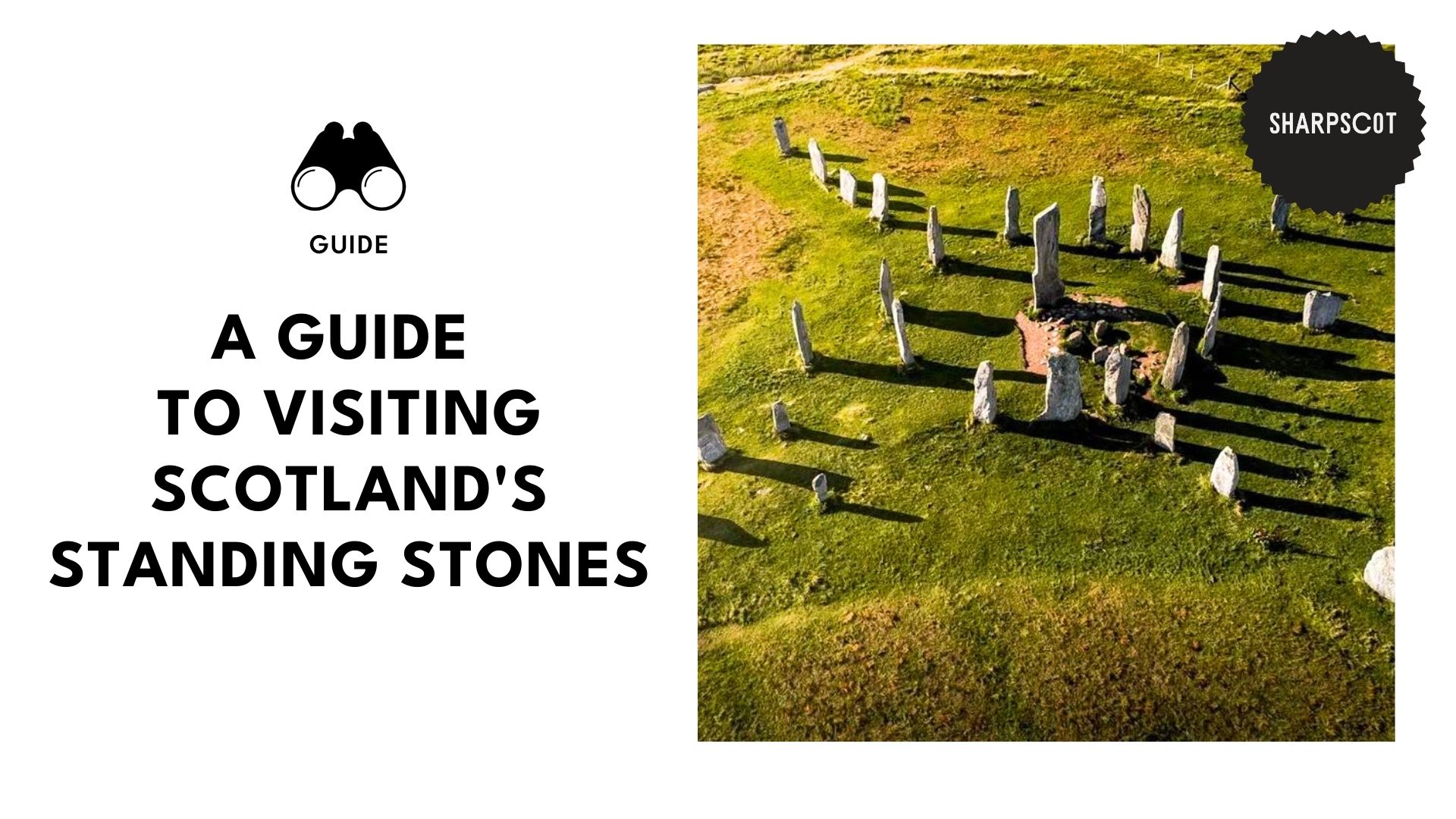
Standing tall for over 5,000 years, the Calanais Standing Stones aren’t just older than our great-grandparents; they’ve been here longer than Stonehenge! As you might expect, the stones are weathered and lichen-covered, proudly wearing the marks of their age.
If that isn’t iconic enough, the stones’ layout forms a massive cross, with 13 primary stones creating a central circle. Right at the heart is a nearly 5-metre-high monolith, believed to have spiritual and astronomical influence, or both, depending on who you ask.
The real story behind the stones? Well, nobody knows. To this day, historians are still debating it, with some theories suggesting it was used for ritual gatherings or even as a prehistoric lunar observatory.
How to Hike to Calanais Standing Stones
Hike Difficulty: Easy
Time Needed: 30–45 minutes for a quick visit; 1–2 hours for a more in-depth exploration
Accessibility: Partially wheelchair-accessible at viewpoints nearby, though not directly around all of the stones
The hike to the Calanais Standing Stones is fairly easy, with gravel and grass paths. While you’ll encounter some slightly uneven areas and gentle but steady inclines, the trail’s suitable for all fitness levels.
If you’ll be venturing out to Callanish II and III stone circles, expect more open moorland terrain. As the paths aren’t clearly marked, you’ll need to bring a GPS or map app.
Pro Tip: The site is believed to be astrologically aligned, so bring a star map to go stargazing and spot alignments.
Ring of Brodgar
Media Credit: visitorkney
Address: B9055, Stromness KW16 3JZ
Getting there:
- By car: It’s a 25–30 minute drive from Kirkwall through the A965 west towards Stromness. From there, take the B9055 right heading to the car park.
- By public transportation: No direct buses. Get on the Stagecoach Bus 8 or Bus X1 headed to Stenness and ask the driver to drop you off near Brodgar. From there, it’s about 1.5 miles or roughly a 30-minute walk along the B9055.
Contact Information: +44 1856 841815
Hours: Open year-round
Price: Free
Website
Believed to have been built between 2500 and 2000 BCE, the Ring of Brodgar is part of a larger Neolithic complex, part of the Heart of Neolithic Orkney UNESCO World Heritage Site. Wider than Stonehenge, it forms a 104-metre-wide circle made out of locally quarried sandstone, each weighing about 4–6 tonnes.
Now, they didn’t just plop the stones down and call it a day. No, sir. The stones are carved into the bedrock, an engineering marvel at the time.
Like the other standing stones, this one’s believed to have been built with solar and lunar alignments in mind. Particularly, to be used for seasonal ceremonies, community meetings, and ritual gatherings, among others.
How to Hike to the Ring of Brodgar
Difficulty: Easy to Moderate
Time Needed: 45 minutes – 1 hour, may take longer if you explore nearby sites
Accessibility: Wheelchair- and buggy-friendly in dry conditions, though not directly around all of the stones, and not officially rated for accessibility
The trail is primarily a flat gravel and grass path, making it easily accessible for all fitness levels and even wheelchair-friendly to an extent.
Since the Ring of Brodgar is connected to several world-class historic sights, you can take longer routes and explore nearby sites that are a part of the complex.
Visitor’s Tip: To get the most immersive experience of the entire ceremonial landscape, visit all the nearby sites of the historical complex, starting from the Ring of Brodgar → Ness of Brodgar → Standing Stones of Stenness → Barnhouse Village.
It will take roughly 1.5–2.5 hours to get around the 4.5 km (2.8-mile loop).
Stones of Stenness
Media Credit: allykeane
Address: Stromness KW16 3JZ
Getting there:
- By car: From Kirkwall, it’s a short 15-minute drive through the A965 to the small parking area by the entrance.
- By public transportation: Take a bus headed to Stenness Village from Kirkwall, then walk about 10 minutes to the site.
Contact Information: 0131 668 8600 (Historic Environment Scotland)
Hours: Open year-round
Price: Free
Website
Another ancient wonder, the Standing Stones of Stenness, are roughly 5,000 years old, dating all the way back to 3100 BCE. Set on the Orkney Mainland, the stones form a part of the UNESCO Heart of Neolithic Orkney World Heritage Site.
Back in the day, these were 12 massive stones arranged in an oval layout. Today, only 4 remain, but even then, it’s still a striking sight. I’m not kidding, these stones are enormous, with the tallest reaching nearly 6 metres high. Trust me, it makes for one heck of a photo op.
They say that the stones were used for sacrifices and rituals, while others place their bets on it being a celestial clock. What we do know is that the site’s cultural significance is huge. Er, just don’t wander around after dark unless you’re feeling brave.
How to Hike to the Stones of Stenness
Difficulty: Easy
Time Needed: Less than 10 minutes
Accessibility: Easily accessible for buggies and wheelchairs, thanks to the flat grass and gravel paths
The hike is, er, relatively non-existent. It’ll take no more than 10 minutes to walk up to the stones from the parking area. As it’s quite a straightforward path with levelled grass and gravelled paths, it’s easy to navigate with a wheelchair or buggy.
Visitor’s Tip: There aren’t any facilities on the site itself, so make sure to bring some snacks, bring your jacket, and do your business (if you catch my drift) before visiting.
Machrie Moor Stone Circles
Address: Isle of Arran KA27 8DX
Getting there:
- By car: From the Brodick Ferry Terminal, it’s a 25-minute car ride via the A841 then B880 west towards Blackwaterfoot.
- By public transportation: Take the 324 bus headed to Machrie or Blackwaterfoot, then ask the driver to drop you off at the Machrie Moor bus stop. From there, it’s a quick 15-minute walk uphill.
Contact Information: 0131 651 6872 (Historic Environment Scotland)
Hours: Open year-round
Price: Free
Website
Aside from the picture-perfect backdrop of the Isle of Arran’s moorlands and hills, the Machrie Moor Stone Circles don’t just have one circle of stones; it has multiple.
The most unique part? Each stone’s different. Some are red sandstones standing tall and flat. Others are low, round granite boulders. And in some cases, even a mix of both materials, making them some of the rarest stone circles in the UK.
A handful of these circles remain mostly intact, while others are broken or missing a couple of pieces. Even then, the miss-mash site is mysterious and otherworldly, especially if you catch it at sunset or sunrise.
How to Hike to the Machrie Moor Stone Circles
Difficulty: Moderate
Time Needed: 40 minutes – 1 hour
Accessibility: Not fully suitable for wheelchairs or push buggies, as the terrain is often boggy
It’s worth noting that the trail length is about 2.5 km return. That, plus gravel and farm track and often muddy and uneven terrain, makes for a horrible combo, especially if you’ll be pushing a wheelchair or buggy along. But if you must bring a carrier, take one with big wheels or an all-terrain buggy, if possible.
Visitor’s Tip: Pack for all sorts of weather. While the moor can experience sunny days, it’s still heavily exposed to wind and rain, which can happen at any moment.
Clava Cairns
Media Credit: davidrabram
Address: Inverness IV2 5EU
Getting there:
- By car: From Inverness, it’s a 15-minute drive just off the B9091 road. Once parked, you’ll spot an info board at the entrance leading to a loop path.
- By public transportation: From Inverness, take a bus headed to Cullen Moor Inn, then ask to be dropped off at the Clava Cairns turnoff. It’s a bit of a walk, around 25 minutes, along a mostly flat, country road.
Contact Information: +44 1667 460 232
Hours: Open year-round
Price: Free
Website
The Clava Cairns are one of those historical sites that require minimal effort from visitors to experience their magnificence. I’m not kidding, the walk to the stones from the car park shouldn’t even take 5 minutes! The best part? You can easily wander at your own pace, reading plaques and taking photos.
The moss-covered slabs have been here for over 4,000 years, something straight out of a fairytale… or an Outlander scene. The passage cairns and stone rings align with the midwinter solstice, a perfect example of early ceremonial architecture. So, don’t go around messing with the stones unless you want to wake something up.
How to Hike to Clava Cairns
Difficulty: Very Easy
Time Needed: Less than 10 minutes
Accessibility: Can be navigated by wheelchairs and buggies in good weather, though not officially rated for accessibility
If you’re allergic to hikes, then visiting Clava Cairns shouldn’t be a problem, as getting to the site is just a short stroll from the car park or the nearest bus stop.
Visitor’s Tip: While you’re there, head over to the Culloden Battlefield just 5 minutes away by car or, if you’re feeling athletic, a 30-minute walk.
Temple Wood
Media Credit: travelingsavage
Address: Lochgilphead PA31 8QG
Getting there:
- By car: If you’re coming from Oban or virtually anywhere else in the north, take the A816 south to Kilmartin Village. But if you’re coming from the South, like Lochgilphead, take the A816 north towards Oban, where you’ll see Kilmartin’s signpost.
- By public transportation: If you’re coming from the north, it’s a 1-hour and 10-minute bus ride via the West Coast Motors Bus 423 to Lochgilphead, then ask to get off at Kilmartin.
Contact Information: +44 1316 688 600
Hours: Open year-round
Price: Free
Website
Don’t let its small size fool you, Temple Wood’s stone circles may be the cuter cousins in the standing stones family, but they’re every bit impressive.
It’s made up of two stone circles: the Southern Circle, made up of 13 stones in a circle about 40 feet in diameter, and the Northern Circle, the smaller and more weathered circle, believed to be the older site.
Temple Wood is believed to have been used for burials and rituals, with excavations uncovering human remains, pottery shards, and even quartz fragments.
Temple Wood Hike Information
Difficulty: Easy
Time Needed: 45 minutes – 1 hour
Accessibility: Can be partially navigated by wheelchairs and buggies in good weather, though not officially rated for accessibility
As the terrain is mostly flat and grassy, it’s quite family-friendly and fairly easy to go through with a wheelchair or buggy. However, some areas may be a little tricky to navigate, especially after rain, as there aren’t any formal boardwalks or paved paths.
Visitor’s Tip: To avoid damaging them, don’t lean, climb, or even touch the stones.
While Temple Wood looks solid, even just touching it can harm the stone, as our bodily oils, sweat, and products like sunscreen or insect repellent can cause chemical wear.
Nether Largie Standing Stones
Media Credit: unlimitedscotland
Address: Baluachraig PA31 8QF
Getting there:
- By car: From the south, it’s roughly 2.5 hours following the A82 north along Loch Lomond, then switching to the A816 south once you’ve passed Lochgilphead. If you’re coming from the north, it’ll take around 40 minutes via the A816 south.
- By public transportation: From Oban, take the 926 or 976 bus headed for Kilmartin. When you get off the bus, it’s a short walk to the site.
Contact Information: 0131 668 8600 (Historic Environment Scotland)
Hours: Open year-round
Price: Free
Website
The cracking thing about the Nether Largie Stones? No Nether portal required. You can easily visit them via car or bus. Kidding aside, these stones are one of the richest archaeological treasures in the UK, dating back to before the pyramids!
You’ll find 5 towering stones arranged in a straight-ish line. At either end, there’s a set of two bigger stones closer together. In the centre, there’s one massive stone with several smaller ones around it, as an anchor.
The site is believed to be positioned to track lunar standstills and celestial events, while others reckon it’s for rituals or gatherings, though its true purpose remains a mystery.
Nether Largie Standing Stones Hike Information
Difficulty: Very easy
Time Needed: 5–10 minutes
Accessibility: Can be navigated by wheelchairs and buggies in good weather, though not officially rated for accessibility
Because the Nether Largie Stones are located in a grass field, there aren’t any paved paths. Even then, the terrain is relatively flat, making it easy to navigate on wheels. However, accessibility is weather-dependent as it can easily become muddy and slippery after rain.
Visitor’s Tip: Pair your trip with a stop at the Kilmartin Museum to learn more about the stones and local archaeology.
East Aquhorthies Stone Circle
Media Credit: outlandercast
Address: Inverurie AB51 5JL
Getting there:
- By car: From Aberdeen, it’s a quick 35-minute drive to the Circle.
- By public transportation: From Aberdeen, take a train or bus headed to Inverurie, then take a taxi to the circle, as there’s no direct bus. If you’re up for it, you can walk 45 minutes to the Circle.
Contact Information: +441316688600
Hours: Open year-round
Price: Free
Website
Wondering what makes the Easter Aquhorthies Stone Circle stand out from the crowd? For starters, it’s one of Scotland’s best preserved circles, and it shows.
The site features 12 standing stones and an eye-catching recumbent stone. Now, don’t let my big words fool you. That’s just a fancy way of saying there’s one massive slab lying on its side.
The real showstopper? The colour contrast of the red granite and grey stones. The best time to visit is during golden hour, as that’s when the colours pop.
East Aquhorthies Stone Circle Hike Information
Difficulty: Easy
Time Needed: Less than 5 minutes
Accessibility: Not fully suitable for wheelchairs or push buggies, as the terrain is often boggy
To be fair, I wouldn’t call the trip to the Circles a hike per se, as it’s just 5 minutes away from the car park. It’s more of a stroll, to be honest, that’s easily accessible for all fitness levels, as it’s mostly flat.
However, the terrain is often boggy, which can make navigation with a wheelchair or buggy challenging.
Visitor’s Tip: There aren’t any nearby toilets, so plan accordingly, as you’ll need to go all the way to Inverurie for the closest facilities.
Clach an Trushal
Media Credit: g_forbsie
Address: Isle of Lewis HS2 0RG
Getting there:
- By car: From Stornoway, it’s an easy 25-minute drive northwest via the A857 towards Ballantrushal. From the layby, it’s a quick walk to the stone.
- By public transportation: From Stornoway, catch bus 58 headed to Ballantrushal. From there, it’s a quick 5-minute walk to the site.
Hours: Open year-round
Price: Free
Website
Nestled in the village of Ballantrushal on the Isle of Lewis, the Clach an Trushal stands tall… literally. Towering at 5.8 meters (19 feet), this single monolith is Scotland’s tallest standing stone.
Thought to be all that remains of what was probably an ancient stone circle, it was likely used for ceremonial or astronomical rituals.
According to local folklore, it’s a symbol of the battle between the Morrisons and the Macaulays, and no, not that Macauley. There aren’t any booby traps here. Either way, it’s been doing a solo act here, probably even feeling lonely, for thousands of years, so it’s highly worth visiting.
Clach an Trushal Hike Information
Difficulty: Easy
Time Needed: Less than 10 minutes
Accessibility: Not fully suitable for wheelchairs or push buggies as there’s no designated path
Heading to the stones from the car park is relatively easy. It’s a quick, 5-minute walk across a grassy field. Just be careful in wet weather as the terrain is uneven and may be boggy, but manageable nevertheless.
Visitor’s Tip: Dress warmly as the wind can get wild, even in the summertime.
Cullerlie Stone Circle
Media Credit: samoth_t_grimshaw_
Address: Skene, Westhill AB32 6UX
Getting there:
- By car: From Aberdeen, head towards Alford via the A944, then turn onto the B9119. Keep an eye out for signs headed towards Garlogie or Echt, then turn and keep driving until you see the car park.
- By public transportation: From Aberdeen, take a bus headed to Westhill or Echt. From the stop, you can take a taxi, which will take about 15–20 minutes if you’re coming from Westhill and around 10 minutes from Echt to the stone circle’s entrance.
Contact Information: +44 1667 460 232
Hours: Open year-round
Price: Free
Website
The Cullerlie Stone Circle is more than just a pit of stones; it has a rare and haunting feature, a set of cremation pits within the stone circle itself. No, these weren’t for fires to keep warm; they were made for the dead.
While quite unusual, it’s an undeniably fascinating feature of the Bronze Age, blending ceremonial and funerary architecture. It stands as the only known example in Britain where a cremation pit is located within a stone circle.
While there aren’t many legends of local spirits tied to the place, the site has an eerie stillness to it, especially if you’re visiting alone. Even then, it’s one to check out if you’re into ancient rituals and archaeological oddities.
Cullerlie Stone Circle Hike Information
Difficulty: Easy
Time Needed: Less than 5 minutes
Accessibility: Can be navigated by wheelchairs and buggies in good weather, though not officially rated for accessibility
The walk to the site is less than 100 metres from the layby, making it doable for virtually all fitness levels. There aren’t any inclines or obstacles to be wary of, making it the perfect activity for children and older adults.
Visitor’s Tip: Since there’s no formal car park, just a small layby, it’s easy to miss, so drive slowly when you’re coming from Garlogie and Echt, so you don’t drive past it.